Showing posts with label Big Muddy National Fish and Wildlife Refuge. Show all posts

August 21, 2016

2017 Solar Eclipse along the Missouri River

The "Line of Totality" crosses the river 8 times - take your pick!

by Steve Schnarr, Missouri River Relief

One year from today will be a super-duper treat here in the middle of Missouri. We’ll experience a total solar eclipse! On August 21, 2017, the path of a total solar eclipse will pass from coast to coast in the United States, arriving mid-day through Missouri. While the greatest extent of the total eclipse will be in southern Illinois, mid-Missouri's experience will be just a few seconds shorter. 

For Missouri River lovers across the state of Missouri, we are really lucky. The “Line of Totality”, which represents the location where  the eclipse will be complete for the longest amount of time (almost 3 minutes along the totality line – with partial coverage lasting almost 3 hours), crosses the Missouri River 8 times. PLUS it crosses the Mississippi River once. 

Now if you thought to yourself…there’s no place I’d rather watch the solar eclipse than on an island on the Missouri River, then you are really in luck. The line of totality passes either through or within several miles of five different islands. During relatively low water flows, three of those islands are big sandbars, with massive views of the sky (one of them isn’t really an island anymore, although it is still called an island…more on that below). Interestingly, four of those islands are part of the Big Muddy National Fish & Wildlife Refuge. 

NASA has put together a great interactive map showing the path of totality. Check it out! –

NOTE - Sure we are obsessing with this line - it's visual and it's fun. But you don't have to be on the center line of the "path of totality" to see the total eclipse. You can be 15 miles away and only miss a few seconds of it. The further away you are from the line the more of the total eclipse you miss (it is a parabolic curve). Play around with the interactive NASA map, or the Xavier Jubier map to see how different locations have different lengths of totality. 

So where are these spots on the river we can get the best experience of the eclipse? 
(I’ll add Google waypoints and additional directional and eclipse timing info here when I get time)

1. St. Joseph, MO – 

(crosses the river at Rivermile 447.3) - The line of totality runs just south of downtown St. Joseph. There is an island about 10 miles upstream of here – Worthwine Island Conservation Area (rivermile 457), but it doesn’t generally have a nice sandbar viewing area. 


2. Hill’s Island – near Waverly, Grand Pass, Malta Bend – 

(crosses the river at rivermiles 288, 279, 276.5) – On this large mitten-shaped series of bend in the river, the line of totality crosses the river three times in just 12 miles of the river. Best spot on the river for viewing? Remote Hill’s Island (rivermile 281). When the river is moderate to lower flows, you can count on a massive sandbar here. This is part of Cranberry Bend Unit of the Big Muddy Refuge. Hill’s Island is only two rivermiles north from the line of totality. 


3. Jameson Island – Arrow Rock, MO – 

(crosses the river at Rivermile 211) The line of totality crosses the mouth of Jameson Chute, which runs through Jameson Island Unit of the Big Muddy National Fish and Wildlife Refuge. From Arrow Rock, you can follow the Lewis and Clark Trail down to the river bottoms. The spot where the trail stops at a sandbar by the river is almost exactly the line of totality. Bring your bugspray for the walk through the forest, but they should calm down once you get to the river. If the river is flooding this trail will not be accessible.  If you have a boat or canoe, though, the largest (and perhaps the highest) sandbar on the Lower Missouri River is just 2 1.2 miles upstream, at about rivermile 213 (Saline County side – right bank descending).


4. Franklin Island Conservation Area – near Boonville, New Franklin – 

(crosses the river near rivermile 193) – Franklin Island isn’t an island anymore, but there is an island across the river (Boonville side) from it! Unfortunately, it’s a pretty steep banked island that doesn’t generally have a nice sandbar viewing area. Just downstream is the Overton Bottoms Unit of the Big Muddy National Fish and Wildlife Refuge, with several nice sandy beaches at lower river levels. 


5. Airplane Island (or Tadpole Island) – near Huntsdale, Lupus – 

(crosses the river at rivermile 179) – This sandbar emerges at about 13.5 feet on the Boonville gage. Just one mile downstream of Katfish Katy’s boat ramp. This is part of the Overton South Unit of the Big Muddy National Fish & Wildlife Refuge. However, the Corps of Engineers is doing a construction project on this sandbar during the winter of 2016-17, so we hope the sandbar still exists in 2017. 


6. St. Aubert’s Island – near Mokane, MO – 

(crosses the river at rivermile 123) – St. Aubert’s Island Unit of the Big Muddy National Fish & Wildlife Refuge is only an island at high water, really. At low water there are some beaches, but nothing really outstanding. The line crosses the river just a couple miles downstream of the Mokane MDC Missouri River Boat Ramp. 


7. Rockwood Island - (OR Grand Island) - Mississippi River 

(crosses the Mississippi River at Rivermile 101) - The "line of totality" crosses the Mississippi River at one location, right through the beautiful sandbar at Rockwood Island, 8 miles downstream of Chester, IL. However, still within just a few miles of that line is one of the most scenic spots on this stretch of the Mississippi - the Grand Tower Rock at rivermile 80. If you pick that historic power spot, you'll only miss a few seconds of full totality. Here's the Rivergator page for more info on the Grand Tower Rock. 

This is the map for Rockwood Island.


See you on the river!!!

NOTE - these maps were generated using Xavier Jubier's interactive eclipse map using Google Maps! Check it out

We'll post more details here as we have time. 

See you on the river!!!

NOTE - these maps were generated using Xavier Jubier's interactive eclipse map using Google Maps! Check it out

April 21, 2011

Big Boats, a Cast Iron Tub and Icy Snow

Confluence Trash Bash
Columbia Bottom Conservation Area – 
Cora Island Unit of the Big Muddy Refuge  
March 28, 2011
text by Steve Schnarr, photos by Melanie Cheney
Check out all of our photos from Confluence Trash Bash 2011 by clicking here. 

I’m attempting to catch up on blogs about the great clean-ups we’ve been helping with lately…Bear with me!

The Confluence Trash Bash is a really unique event. People from several different creek watersheds join in to have a massive stream and river clean-up on the same day. The connecting tissue of all of these watersheds is that muddy water that runs out of the Missouri River and hugs the west side of the Mississippi as it flows downstream.

The event is a partnership of countless community groups. The Confluence Partnership, Trailnet and the St. Louis Metropolitan Sewer District lead the way, but everybody makes it happen.

Confluence Trash Bash 3-26-11
photo by Melanie Cheney

While hundreds of community volunteers scoured the streams through their North St. Louis towns, we were one of several big river sites that day. And it should be said (as always, it seems, with the Confluence Trash Bash), the weather wasn’t the best.

Here's the other two big river sites:
Big Muddy Adventures and River Kids hopped in canoes to clean up Mosenthein Island – the massive forested island in the only “non-navigable” stretch of the Mississippi channel.They estimated piling up over 2 tons of tires, barrels and bagged up trash...which they spent the next couple days hauling to shore in canoes.

The Piasa Palisades Sierra Club and the Corps of Engineers tackled two big sites on either side of the Alton bridge on the Alton Pool of the Mississippi.4 tires, a recliner and the parts of a meth lab....so good to get that stuff out of there! Good work guys!

We put folks out in boats from the Columbia Bottom access. Because of the cold, blustery conditions and the threat of snow, many folks that signed up for our Missouri River site just plain didn’t show up. The solution to that was to rob volunteers from other sites that had more than enough.

The site groups were all gathered on straw bale rings near registration. One by one I was able to ask the groups…who wanted to help us on the big river - where it was cold, windy and dangerous. Most people would look at each other and shake their heads. A few in each group smiled. Those folks got maps from me and headed to Columbia Bottom.

In bad weather, there are two clean-up sites near Columbia Bottom that people can always work on. The cool thing is - they are directly across the river from each other just a mile and a half upstream of the boat ramp.

One is a low bank, outside bend spot that always collects tons of trash coming out of Coldwater Creek. Always lots of toys.

Confluence Trash Bash 3-26-11
photo by Melanie Cheney

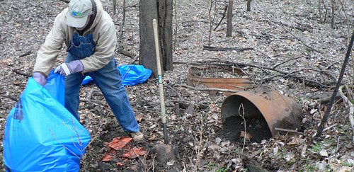
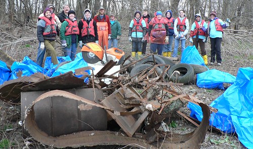
The other is an old farm dump on the newly opened Cora Island Unit of the Big Muddy Refuge. We’ve been working on this for several years – along with a contractor with the Army Corps of Engineers. The heavy equipment hauled out the big stuff, volunteers are sweeping up everything else the hard way.

Confluence Trash Bash 3-26-11
photo by Melanie Cheney

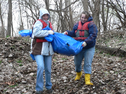
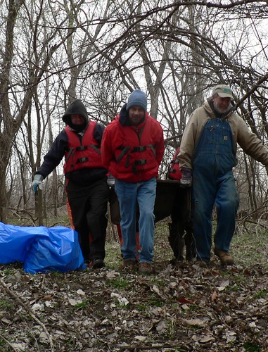
Shovels and pry bars, ropes and teamwork. And it is just amazing to see the difference!  This year’s prize was a cast iron tub. It took six people to haul out through the cottonwood forest.

How many river rats does it take to move a cast iron tub?
 photo by Melanie Cheney

The piles that grew on both sides of the river were amazing. And felt so good.

After several hours of scouring the banks for trash, we hauled most folks back to shore. They were headed back to a great lunch and celebration at the Old Chain of Rocks Bridge. Trash Contest…the whole deal.

We headed back out to bring all that trash back before the predicted snow. A whole bunch of folks stuck around for the trash haul, and it went smooth as it could be. As we finished, a hot lunch arrived from the Bridge and we hunkered down in the new Columbia Bottom pavilion and feasted.

Here's a beautiful thing: as we came off the river, all of our friends from the area that just finished up their sites came to help us finish off ours...and clean our tools and pack up. If my face wasn't froze I would've cried.

Confluence Trash Bash 3-26-11
photo by Melanie Cheney

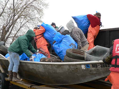
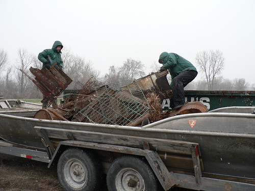
We trailered our boats full of trash. Landfill junk got offloaded at the dumpster at the ramp. Everything else (tires, scrap metal, a cracked tub) we kept in the boats and dragged to the Old Chain of Rocks Bridge….that amazing, crooked pedestrian bridge across the Mighty Miss. We added our pile of junk to the amazing pile that people had gathered all day in a string of dumpsters full of metal, trash bags and tires.

Confluence Trash Bash 3-26-11
photo by Melanie Cheney

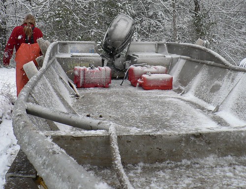
The ride home was into the teeth of the snowstorm, trying to get our boats and vans back home while we could still park them in our boat yard. It worked, but our boats and vehicles were all coated with a half inch of ice by the time we made it back home.

The snow was gone by the next afternoon.

Icy boat
photo by Melanie Cheney

June 1, 2009

Troy Gordon Memorial Project

May 23rd, 2009

Arrow Rock, MO


A little over a year ago, we lost a great friend & partner, Troy Gordon. As many of his friends & family came together to share a story, a hug or a laugh, we collected almost $2,000 to fund a memorial project to honor this special fallen hero. After all, it was not Troy’s spirit to stand around & contemplate, but to act! And we did just that on a beautiful Saturday morning in the little historic town of Arrow Rock on Memorial Day weekend.


Troy passionately worked on behalf of many organizations. Among them, the Big Muddy National Fish & Wildlife Refuge, Missouri Master Naturalist, Missouri River Relief, Missouri Stream Team, and he founded & worked with Friends of Big Muddy just to name a few. He focused much of that work in the bottomlands of the Missouri River in addition to his educational efforts, introducing kids and adults to the birds, snakes, turtles and other wildlife that live in Missouri.


To honor Troy’s life work, we chose a trail that he had worked so hard to help implement with Fish & Wildlife partner, Tim Haller at the Jameson Island Unit of the Big Muddy Fish & Wildlife Refuge in Arrow Rock. In addition to Jameson Island, there are currently 7 other units of protected river habitat in the Big Muddy Refuge. Comprised of 11,000 acres strung up and down the lower Missouri River, this important resource continues to grow and evolve as the Fish & Wildlife Service acquire more of the Big Muddy’s floodplain from willing sellers, restoring and preserving parts of this once wild ecosystem. For more info. on the Big Muddy refuge, visit their website.


On a warm & steamy May morning, Friends of Big Muddy came together once again for a work project on the refuge, like so many that Troy had organized in the past. With project funds donated in his name, we built a platform to place a memorial plaque & bench along the Arrow Rock Landing trail to the river, and replaced many of the invasive & nuisance plant species taking over the bottoms with over a hundred native wildflower’s & shrubs! So instead of Garlic Mustard, Multi-flora Rose & Winter Creeper, there are now Wild Sweet Williams, Celandine Poppy’s, Spiderwort’s, Golden Ragwort’s, Wild Ginger, Silky Dogwood’s, Paw-Paw’s, False Indigo’s & Buttonbush’s. It was a beautiful sight.


We followed our workday with a gourmet BBQ lunch, good company, and a quiet feeling of triumph as Friends of Big Muddy was resurrected after more than a year. Mostly, I feel thankful for all of the organizations & people that Troy has brought together. He certainly left a lasting legacy, and some pretty big foot steps to fill, but I feel confident that in due time we will close the huge gap that he left, with each new step.


Special thanks goes out to Tim Haller, Randy & Tom Bell of the Big Muddy Fish & Wildlife Refuge for all of their hard work & coordination in making this event go off without a hitch, Troy’s widow Janine, for being such a trooper and continuing to help us fill his footsteps, Tim Nigh & Dinise Mustain for preparing our gourmet lunch, the local farmer’s for providing us their with quality, feel-good-food, Missouri River Relief’s new hard-core crew members for volunteering for the work day even though they didn’t know Troy, and the many friends, partners, & family that donated either their time, support or money to help create such a nice tribute & memorial to Troy.


Thank you.

May 1, 2009

Rocheport Trash Tally!

Rocheport Bend Day of Caring
April 18, 2009
Rocheport, MO, and Overton Bottoms Unit of Big Muddy Refuge


Here's some results and a trash tally from this amazing day!

Thanks to everyone that made it happen...

Total Volunteers: 133 (73 clean-up volunteers)
MRR Crew: 32
Boats: 4 (3 Missouri River Relief; 1 Mo. Dept. of Conservation)
Stream Teams: The Mighty 211, 549, 1875, 1876, 2489, 2793
Rivermiles: 2
River level: 10.8 (Boonville gage)
Scrap Tons: 1 ton
Landfill Tons: 3 tons
Tires: 111 (est. 1.7 tons)
Total Tonnage: 5.7 tons
Bags of Garlic Mustard Pulled: 56 large bags
Trees Planted: 300 trees

Trash Tally!
More than 114 Large Stream Team Bags
111 Tires: 72 on the rim, 37 w/o rims, 1 truck tire, 2 inner tubes, 1 bicycle
4 Refrigerators
1 Chest Freezer in parts (tagged on 06 MegaScout trash survey)
1 Hot Water Heater
1 Dryer
5 Coolers
1 Bed Frames
4 Box Springs
5 Chairs
4 30-gallon Trash Cans
4 5-gallon Plastic Buckets
80 feet of 1” Poly Tubing
9 1-gallon Paint/Varnish Cans
10 feet of Garden Hose
10 feet of Plastic Piping
17 assorted Scrap Metal pieces
1 Hot Tub w/ Cover
1 Ironing Board
1 very ugly old woman rubber mask
1 Lock Pick Set
1 Lot Fence Wire
3 3-gallon Metal Buckets
1 Typewriter
3 55-gallon Metal Drums
1 Park Bench
1 Camping Table
1 Truck Bed Liner
1 Fire Extinguisher
1 Toilet
Several hundreds of pounds of roof shingles
1 Kitchen Sink
13 Mason Canning Jars

Jody Coats shows off a piece of a big freezer. photo by Scot Heidbrink

Gettin' it done in Rocheport

Rocheport Bend Day of Caring
April 18, 2009
Rocheport, MO, and Overton Bottoms Unit of Big Muddy Refuge

text by Steve Schnarr, photos by Scot Heidbrink & Melanie Cheney
check out our Rocheport Results webpage for more links & info

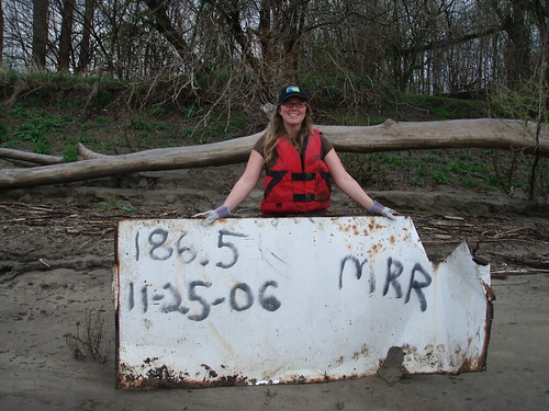
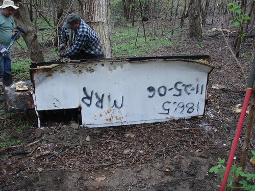
It all started with a commercial freezer. We came across this thing in 2006, when we were finishing off the home stretch on our MegaScout trash survey. During the previous summer and fall, we’d mapped trash on 754 miles of the Missouri, from Ponca, NE, to the Confluence north of St. Louis, MO. For thanksgiving weekend, we finished off the home stretch, from Boonville to Jeff City.

Racin’ Dave and I spotted a pile of tires and a big appliance. We GPS’d the spot (just upstream of Moniteau Creek next to Rocheport) and Racin’ spray-painted the rivermile and date on the side of the freezer lest it float away before we get it. (so far we’ve found several of these “tagged” items at clean-ups. The furthest travelled was 326 miles – click here to check out the blog post)

So when Missouri River Communities Network (MRCN) Vista member Maria Dorsey asked us if we wanted to add a clean-up component to their annual Rocheport Day of Caring on April 18, I immediately thought of that freezer. And all the trash along the Katy Trail and the tires scattered through the woods by many floods.

Soon, there was more. The Big Muddy Refuge across the river wanted volunteers to have a garlic mustard-pulling party, and that was the only weekend they could do it. So it became the Rocheport Bend Day of Caring – volunteer efforts spread on both sides of the river to improve the land.

Students from a West Junior High French Class gathered to plant 300 trees throughout city parks and along Moniteau Creek. This project was organized by Maria, then-Rocheport mayor Brett Dufur, and MRCN Americorps workers Katrina Thomas and Pam Venable. The Friends of Rocheport worked with us to put on lunch for the whole crew.

We decided to do a three-prong clean-up assault. One team worked on pulling down the remains of a collapsed building right along the Katy Trail. They bagged up the shingles and trash and left a monster burn pile ready to go. It took all morning with a chainsaw, a gas-powered chop saw, hammers, pry bars and shovels. Tires from the surrounding woods were rolled to the trail and bags of trash emerged from the surrounding forest.

Another several groups cleaned along the Katy Trail, walking deep into the forest and rolling out tires and all kinds of junk.

And some more folks hit the river, walking down the Riverwalk trail to the mouth of Moniteau Creek to meet the River Relief boat fleet. Boats took crews to the site of the aforementioned freezer, as well as a couple spots near the old head (now closed) of the Overton Chute.

The original Overton Chute had a sharp bend near its entrance, and quickly became clogged with driftwood. So the Corps of Engineers punched in a new entrance just
downstream. But driftwood and a whole lot of trash still collects in the old entrance (a spot Refuge Biologist Wedge Watkins told us about and flagged for us). Volunteers struggled through the driftwood, dragging bags full of plastic and glass and rolling refrigerators and tires to shore to be hauled away by boat.

Meanwhile, volunteers Don Doughtery (who drove to the cleanup in the rain in his cool go-cart) and Alvin Sweezer broke that freezer into manageable pieces that could be hauled to shore.

Even though this was a relatively small clean-up, it was one of our most complicated, with volunteers showing up at Rocheport and then walking 1/2 mile to board boats. Boats were launched across the river at Taylor's Landing, where trash was also hauled out. Plus, the overpass to Taylor's Landing was closed, meaning an extra 10 minute drive for hauling trash and boats by land.

So activity was buzzing all over the river that day, and a whole lot got accomplished. 300 trees were planted, 56 huge bags of garlic mustard were pulled, 111 tires were removed from town and the river, and 5.7 tons of trash were hauled away.

Thanks to everyone who came out on a soggy Saturday to help beautify the Rocheport Bend!!!!

Special thanks to Brett and Tawnee Dufur, who hosted our crew camp at their beautiful Katy Trail Bed and Bikefest, and made a bunch of other things easier.

Thanks to the City of Rocheport for contributing to our lunch and disposal costs.

And thanks to the Missouri Department of Natural Resources for funding Missouri River clean-ups.